
Welcome to Paria's “Hike of the Week” series. These posts highlight some of the best trails from around the U.S. and beyond. Reading about a great hike is nice, but we hope this series inspires you to get out and see these trails for yourself!
This week we cover the Tonquin Valley in the Canadian Rockies.
Featured Photo: Tonquin Valley Panorama (photo by Steffen Sauder)
Why Hike Tonquin Valley?
The Tonquin Valley is one of Canada’s premier alpine regions which has been popularized in postcards for its breathtaking views of Amethyst Lake which sits at the base of the picturesque Ramparts Mountain Range.
- 43 kilometer / 27-mile hike through the Canadian Rockies. Expect the hike to take 2-4 days of moderate difficulty.
- Starting Elevation (Portal Creek Trailhead): 1,494 meters / 4,914 feet
- Highest Elevation: 2,210 meters / 7,250 feet
- The road to the Astoria Creek Trailhead is open seasonally depending on snowmelt. It is generally open May-October for pedestrians and mid June for vehicles. Check here for seasonal opening and closing dates.
- Best time to hike the Tonquin Valley is late summer (late August through September) as summer months tend to have muddier trails and more prolific mosquitos. Though be prepared for muddy trails regardless of when you go.
- Average temperatures: August 18°C high / 2°C low; September 13°C high / -2°C low
- There are 7 campsites available to book (Portal, Maccarib, Amethyst, Surprise Point, Clitheroe, Switchback and Astoria). You will want to get a spot at Amethyst or Surprise Point to get the most out of this trip as they provide spectacular views of the Ramparts.
- Book campsites early as there are limited spots available. All sites need to be pre-booked. There are no walk up campsites.
- Day trips to Emerite Valley and Moat Lake from the Tonquin Valley Trail can be added to your itinerary if you have the time.
- More expensive cabin/lodging options are available near Amethyst Lake through Tonquin Valley Backcountry Lodge and Tonquin Valley Adventures.
- Plenty of wildlife in the area including grizzly bears, black bears, and mountain caribou.
- Bear poles are provided at campsites to store food.
- No fires are permitted. Bikes and dogs are also not allowed.
How Do I Get There?
Edmonton International Airport is the closest international airport to Jasper, while Jasper is the nearest city to the Tonquin Valley trail. It will be about a 4 hour drive from Edmonton International Airport to Jasper where you will find plenty of options for accommodation to spend the night prior to beginning your hike.
There are 2 trailheads to choose from when beginning your hike: the Portal Creek Trailhead which is a 16km drive from Jasper; and the Astoria Creek Trailhead which is a 29km drive from Jasper. To get to the Astoria Creek Trailhead you will need to take highway 93A from Jasper and then turn right on Edith Cavell Road. Follow this road for 12km where you will approach Hostelling International’s Edith Cavell Hostel. The trailhead is near this hostel.
Your hike will start at one trailhead and end at the other. As such, you will likely need two vehicles or arrange another way to get back to your vehicle.
Map of Recommended Route
The following map outlines our recommended route. For even more detailed mapping, including being able to print a copy for yourself, click the "Open in CalTopo" button at the top of the map once it's loaded into view.
- Day 1 - Portal Trailhead to Portal Campgrounds
- Day 2 - Portal Campgrounds to Amethyst Campgrounds
- Day 3 - Amethyst Campgrounds to Astoria Campgrounds
- Day 4 - Astoria Campgrounds to Astoria Trailhead
Trail
The following preferred route is dependent on having two vehicles or another means of shuttling yourself back to your vehicle. If you only have access to one vehicle you may choose to hike halfway to either Amethyst or Surprise Point Campgrounds and then back the way you came. Both aforementioned campgrounds will give you unprecedented views of the Ramparts which is why you likely chose to hike the Tonquin Valley in the first place.
Day 1 - Portal Trailhead to Portal Campgrounds
The first day of hiking is just under 9 kilometers in distance. This is ideal as it gives you time to enjoy a breakfast in Jasper and then to drop your second vehicle off at the Astoria Trailhead prior to commencing the day's journey.
You will begin your hike through Tonquin Valley at the Portal Creek Trailhead (1,494 meters / 4,914 feet elevation). You will travel through dense forest for the first half of the day before opening up to views of the valley. There is a short descent just prior to your campgrounds as you head down towards Portal Creek where you will find Portal Campgrounds (1,979 meters / 6,494 feet elevation), your stopping point for the night.
You will have gained approximately 485 meters / 1,591 feet of elevation over the course of the day.
Day 2 - Portal Campgrounds to Amethyst Campgrounds
Today you will travel 14.2 kilometers. Upon leaving Portal Campgrounds you will gain over 200 meters as you head towards Maccarib Pass (2206 meters/7238 feet elevation) before descending towards some marshy and potentially quite muddy meadows. You will reach Maccarib Creek approximately 11 kilometers in. After Maccarib Creek the trail evens out and remains fairly level over the next 3.4 kilometers to Amethyst Campgrounds.
The Amethyst Campgrounds will likely be the highlight of your trip as you get unbelievable views of the Ramparts while being a short distance from Amethyst Lake. This magnificent backdrop makes it an ideal spot to spend your evening.
Day 3 - Amethyst Campgrounds to Astoria Campgrounds
Day 3 will see you hike 13.3 kilometers. Wake up and soak up some more views of the Ramparts as you eat your breakfast prior to departing camp.
Your hike will begin on a mainly flat trail. There will be a fairly long boardwalk over a bog that leads to Clitheroe Campgrounds which is about 100 meters/328 feet higher in elevation than Amethyst Campgrounds. From Clitheroe Campgrounds to Switchback Campgrounds you will remain on level ground, not gaining or losing much in elevation. Just past the Switchback Campgrounds you will start to descend over the next 4 kilometers (a little under 400 meters/1310 feet). You will pass through a rockslide near Old Horn Mountain. There will be a sign on trail prior to the rockslide warning you to not stop over the next 300 meters. From here, the path levels out as you follow the Astoria River over the last 3 kilometers of the day's hike to Astoria Campgrounds.
Day 4 - Astoria Campgrounds to Astoria Trailhead
This will be another short day as you will only have to hike 7.1 kilometers to get to the trailhead. If you are a strong hiker you may choose to forgo this added day by hiking to the Astoria Trailhead on day 3. It will make for a longer hike on day 3 but is doable.
There will be very little elevation gained or lost today. You will continue to follow alongside the Astoria River as you make your way out of the trail. The last few hundred meters of the day will be the most scenic with electrifying views of Mount Edith Cavell.
What Will I Need?
Mud and bugs can be problematic especially during the summer months. As such, plan on bringing gaiters, and trekking poles to navigate through the mud as well as some form of mosquito protection.
Bear spray and/or bear bangers would also be beneficial on this hike as both grizzly and black bears can be found in the area.
You will also want to be prepared for wet weather. This means you will likely need a rain jacket as well as a pack cover or pack liner to protect your gear (there is nothing worse than trying to sleep in a wet sleeping bag on a cold night.
It can get fairly cold at night. If hiking the Tonquin Valley in late August or September then temperatures below freezing are definitely possible. Therefore you will want to bring a puffy jacket for the evenings and mornings at camp. You may also look at bringing dedicated clothes for sleeping if you run cold at night. This will enable you to sleep with dry clothing at night to keep warm.
In addition to clothing, a good sleep system will enable you to stay warm overnight. You will want a sleeping bag rated for the temperatures you expect to find on trail. In this case, a sleeping bag that is rated below freezing is appropriate if hiking in late August or September. To complete your sleep system, a sleeping pad that has an r-value over 3 is recommended. You may also want to consider a pump bag to make inflating your pad an easier endeavor.
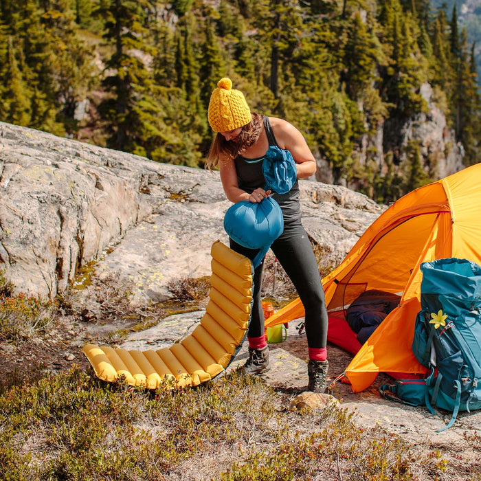
A lightweight, insulated sleeping pad can make for a comfortable night on the trail. To save your lungs at the higher elevations, consider getting a pump sack as well.
A spacious tent can be handy on trail as it let you store some gear inside the tent at night and provides you the headroom to sit up in your tent and maneuver around without feeling constricted.
Finally you will need a cooking set up. This will include a lightweight stove, a cooking pot and utensils at a minimum. If you are mainly boiling water for dehydrated meals then a long titanium spork or spoon will be ideal. In addition, you may want to bring a mug if you are looking at having a warm beverage on trail. If you are looking for additional comfort while eating or resting at camp then a sit pad may be an optional item that you may wish to bring.
If there's anything else you need to complete your pack, visit our full line of high-quality, affordable backpacking gear.
Shop Backpacking Tents
Shop Ultralight Tarps
Shop Backpacking Quilts
Shop Down Sleeping Bags
Shop Insulated Sleeping Pads
Shop Backpacking Pillow
Shop Folding Trekking Poles
Shop Titanium Cookware
Shop Tent and Tarp Accessories
Finally, to make sure you don't forget something at home, use our Ultimate Backpacker's Packing List. It even includes a convenient printable checklist!
Do I Need a Permit?
Yes. A backcountry camping permit is required for all overnight trips. This can be obtained online or by calling 1-877-737-3783.
When booking online make sure to select backcountry camping under reservation type and Jasper as your park. On the next page you will have to select backcountry campsites which will take you to a list of backcountry trails in the area. Select Tonquin Valley and then the campsites you would like to reserve.
Resources
Astoria Creek Trailhead open/closure dates
Online booking for campsites
Tonquin Valley Backcountry Lodge
Tonquin Valley Adventures
Edmonton International Airport to Jasper directions
Jasper to Portal Creek Trailhead directions
Jasper accommodation options
Tonquin Valley weather forecast
Conclusion
The Ramparts mountain range in the Tonquin Valley provides stunning scenery which make this a premier destination for those looking for a hike with picturesque mountain views.
Read Next
Be sure to check out the following Hike of the Week articles for other hiking options in the Canadian Rockies.
Hike of the Week: Berg Lake Trail
Hike of the Week: Skyline Trail
Hike of the Week: The Rockwall
Hike of the Week: Sunshine Village To Mount Assiniboine
For even more amazing backpacking trips visit The Trailhead, our interactive hike map. It contains a curated list of dozens of hikes, each with a detailed writeup like this one.

Finally, check out our comprehensive list of backpacking articles that cover just about everything there is to know about backpacking. If you're just starting out, our Backpacking 101 section covers all the basics. If you already have a few trips under your belt, you can find more advanced topics covered in our Expert Articles.


It’s really amazing there – 5 different valleys feed into the Tonquin so quite the ecological treasure. Most sites will already be booked though in first couple days of reservations opening, so need to watch for cancellations, may need to pull a longer day. Couple notes if you do get lucky with sites. Tonquin home to threatened woodland caribou, so no dogs allowed. Also, no hammocks per Parks Canada (many of the tent sites don’t have trees big enough). You can arrange an expensive ($100 CAD) cab from Portal to Astoria trailhead, so possible to park at final destination and get a ride to where you start. You can also save a few bucks staying overnight in Hinton, which is an hour drive from Jasper townsite (50 miles / 80km) and then another 15-20 min to Portal trailhead. More and cheaper choices than Jasper itself if you’re on a budget, but miss the opportunity to spend a day in the park before hitting trail. Considering an Arches 2 for my Tonquin solo in Sept, loved it so much last year I need to go back :)
Leave a comment