
This article highlights an outstanding day hike or backpacking trip. The goal is to inspire you to want to get out and see these places for yourself. I know for us, just seeing amazing photos and reading about a great hike is enough to get us motivated.
This week's hike is The Rockwall Trail in Canada's Kootenay National Park.
Why This Hike?
Nothing compares to the stunning beauty of the Canadian Rockies. Located in Kootenay National Park, the Rockwall is a single, massive cliff, towering almost 3,000 feet above the trail. The Rockwall Trail parallels the cliff for approximately 34 miles. You can also expect mountains, alpine meadows, wildflowers, and creeks.
- Length: 34 miles
- Type: Point-to-point
- Difficulty: Challenging
- Best time to visit: June-September
- The trail is well-maintained and easy to follow.
- The trail is accessible via multiple trailheads. So, there are several entry and exit points if you run into trouble.
- There are 5 campgrounds along the trail.
- Plan on taking 3-5 days to complete the trail.
- Some other highlights include Helmet Falls and Floe Lake.
- Dogs are allowed as long as they are leashed.
Before you pack your bags, keep the following in mind:
- It is Canada and there are bears. Be bear aware!
- The weather can be quite rainy, so dress and pack accordingly.
How Do I Get There?
Both Floe Lake Trailhead (if you plan to hike from south to north) and Paint Pots Trailhead (if you wish to start from the north) are accessible via Highway 93, which runs through Kootenay National Park. You will need a personal vehicle to reach them, since there are no shuttle services in the area. The most convenient arrival point is Calgary International Airport, which is about two hours east of the park. You can rent a vehicle there and drive to the trailhead. If you're arriving from low elevations, we recommend you spend at least one night before heading out on the trail to get acclimated to the higher elevations.
Map
The following map outlines our recommended route. For even more detailed mapping, including being able to print a copy for yourself, click the "Open in CalTopo" button at the top of the map once it's loaded into view.
As mentioned, we recommend a five day / four night journey for this trip in order to thoroughly enjoy the scenery. This itinerary starts at the northern side and culminates at Floe Lake before existing at the Floe Lake Trailhead. The total distance is approximately 33.6 miles (54.1 km). It is also worth noting that the two trailheads are just 13 kilometers away from each other.
- Day 1 - Paint Pots Trailhead to Helmet Creek (14.7 km)
- Day 2 - Helmet Creek to Tumbling Creek (11.9 km)
- Day 3 - Tumbling Creek to Numa Creek (7.1 km)
- Day 4 - Numa Creek to Floe Lake (9.7 km)
- Day 5 - Floe Lake to Floe Lake Trailhead (10.7 km)
Trail Description
Day 1 - Paint Pots Trailhead to Helmet Creek
You will start your journey on a relatively easy path through trees. By the time you reach Helmet Creek, you will get the chance to see Helmet Falls which makes for a very impressive sight.
Day 2 - Helmet Creek to Tumbling Creek
On your second day, you will start your climb to Rockwall Pass and get your first view of the Rockwall once you're past the treeline. You will hike past Wolverine Pass before reaching the Tumbling Creek campground where you can pitch your tent for the night.
Day 3 - Tumbling Creek to Numa Creek
On day three, you will start your hike over Tumbling Pass and go down the steep southern side. We recommend the use of hiking poles on this part. You'll arrive at Numa Creek campground for your third night on the trail.
Day 4 - Numa Creek to Floe Lake
The next morning, you'll quickly start you ascent to Numa Pass, which is the highest point on the Rockwall trail. From there, you will hike down Floe Lake where you can spend your last night. You may experience loud cracking sounds while staying at the lake; no worries, they are just ice calving into Floe Lake.
Day 5 - Floe Lake to Floe Lake Trailhead
The last leg of your hike will be relatively easy as you descend through alpine meadows and switchbacks. Near the very end, you'll experience the remains of burnt tree trunks from a large 2003 wildfire.
Please note that Numa Creek and Tumbling Creek’s bridges have recently been washed out and the trail is filled with avalanche debris. Please refer to the Kootenay National Park website for the most current information.
What Will I Need?
The trail is well-maintained. Each campsite has access to running water, bear lockers, and tent pads. While there are plenty of water sources, keep in mind that water purification is a must. So, be sure to bring your water filter or purification tablets. Weather can be erratic, so be prepared for rainy days during the summer and rain/snow during the shoulder season. A lightweight tarp makes an excellent, quick shelter. Some waterproof stuff sacks will keep your gear dry.
Even during the summer months, it can get a bit chilly at night. Make sure you have an appropriately rated sleeping pad. (And a pump bag or small battery-powered pump to save your breath.) A down quilt will help keep you warm too. This is a rugged trip. A compact backpacking tent is your best bet.
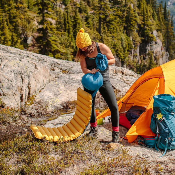
A lightweight, insulated sleeping pad can make for a comfortable night on the trail. To save your lungs at the higher elevations, consider getting a pump sack as well.
Knowing where the exit points are and a detailed map will certainly help in the event that you need to leave sooner than expected. The National Park website provides a good map that you can print out.
Since the area is frequented by bears, make sure that you practice bear safety and watch out for elk as well. Definitely bring your camera with you to capture the amazing sights and wildlife!
If there's anything else you need to complete your pack, visit our full line of high-quality, affordable backpacking gear.
Shop Backpacking Tents
Shop Ultralight Tarps
Shop Backpacking Quilts
Shop Down Sleeping Bags
Shop Insulated Sleeping Pads
Shop Backpacking Pillow
Shop Folding Trekking Poles
Shop Titanium Cookware
Shop Tent and Tarp Accessories
Finally, to make sure you don't forget something at home, use our Ultimate Backpacker's Packing List. It even includes a convenient printable checklist!
Do I Need a Permit?
Kootenay National Park requires its visitors to get a daily or annual backcountry use and camping permit. Campsite reservations in advance are required. If you want to fish along the trip, fishing is allowed for those who have a National Park Fishing Permit.
Resources
Kootenay National Park (for permits)
Phone: 250-347-9505
Email: kootenay.info@pc.gc.ca
Conclusion
Have you hiked the Canadian Rockies? Do you have other outstanding hikes that you'd like us to write about? Please share your feedback in the comments.
Read Next
If you're looking for more hike ideas, read our “The Best Hikes in the Canadian Rockies” round-up post. Also, the following Hike of the Week articles cover other great trails in the region.
Hike of the Week: Sunshine Valley to Mount Assiniboine
Hike of the Week: Tonquin Valley
Hike of the Week: Berg Lake Trail
For even more amazing backpacking trips, visit The Trailhead, our interactive hike map. It contains a curated list of dozens of hikes, each with a detailed write-up like this one.

Finally, check out our comprehensive list of backpacking articles that cover just about everything there is to know about backpacking. If you're just starting out, our Backpacking 101 section covers all the basics. If you already have a few trips under your belt, you can find more advanced topics covered in our Expert Articles.


Leave a comment