
Sometimes all it takes is a few pictures and some details to get us inspired for our next epic adventure, whether it be a short jaunt through the woods or a grueling peak climb. In our Hike of the Week series, we strive to get you motivated to go out and experience great trails in person, both domestic and abroad.
This week's hike highlights a several-day long backpacking trip from Onion Valley to Mt. Whitney in California's Sierra Mountains.
Featured Photo: Mount Whitney (photo by Joe Parks)
Why Hike Onion Valley to Mt. Whitney?
On this fun, but challenging 4-day hike through the High Sierra Mountains of California, you will pass plenty of glass-like lakes and ponds, including Bullfrog Lake and Tyndall Frog Ponds (which are great for swimming and bathing), traverse rugged passes, climb Forrester Pass, the highest on the Pacific Crest Trail, and finally end your trip by summiting the highest peak in the lower 48 states.
- Summit Mt. Whitney (14,505 ft), the highest peak in the 48 contiguous states
- Difficult trail, better suited for experienced backpackers
- Mt. Whitney can be very tricky in snowy or rainy weather
- 4 days (although there are plenty of fine camping spots along the way to extend your trip if desired)
- The total length is 44 miles with 11,500 ft of elevation gain
- Get up early on the last day of your trip and experience a Mt. Whitney sunrise
Before you pack your bags, here are a few things to keep in mind:
- June through September is the best time to plan your trip, although...
- It can be hot and buggy July and August
- Average highs range between 65-80°F, average lows of 32-45° between the end of June and mid-October
- Beware of altitude sickness if you're not used to hiking mountain summits or are coming from sea level
- No fires above 10,000 feet in John Muir Wilderness and Kings Canyon National Park; no fires at all on Mt. Whitney and Inyo National Forest (Onion Valley portion)
- You must carry your human waste out as there are no toilets along Mt. Whitney and it is mostly rock
- You must use provided bear-proof lockers or bring your own bear-resistant canisters to use for food, trash, and scented items everywhere but Mt. Whitney
- Need to drop a second car off at Whitney Portal or arrange other transportation/shuttle service
How do I get there?
There are several major airports that would serve this hike. Reno, Fresno, Las Vegas, and Los Angeles are all about 4 hours away and should make an easy destination from anywhere in the country. Once you've landed, head into Independence, CA on Highway 395. In town, turn onto West Market Street. Keep following this route as it turns into Onion Valley Road. You will travel about 25 minutes from Independence to the Kearsarge Trailhead in Onion Valley. There is a hikers' parking lot conveniently located next to the trailhead.
If you only have one vehicle, you'll need to use a shuttle to arrange transportation from the end of the hike at Mt. Whitney Portal back to Onion Valley. East Side Sierra Shuttles provides shuttles for most of the eastern Sierra destinations, so they're a great option.
Map of Recommended Route
The following map outlines our recommended route. Click the "Load Interactive Map" button to load the correct map. Once loaded, you can navigate along the route and view recommended camp sites.
We recommend a 4-day, 3-night trip in this article, but you may wish to add an extra night to the beginning of your trip to get acclimated to the elevation. Other hikers have also recommended spending another night at one of the base camps of Mt. Whitney after you have summited.
- Day 1: Bubbs Creek (11 miles)
- Day 2: Tyndall Creek (11 miles)
- Day 3: Guitar Lake (11 miles)
- Day 4: Whitney Portal (11 miles)
Bringing a GPS device along would be a wise choice as some areas of the trail are inconspicuous.
Trail Description
Day 1 - Bubbs Creek
Start your journey at the Kearsarge Pass trailhead near the Onion Valley Campground. Your first challenge will be climbing the 11,760ft pass. Enjoy plenty of lake views on your trek up, as well as the awesome views all around once you reach the top. (It is about 4 miles to the pass from the trailhead.) Make your way back down for some more beautiful lake views, including Bullfrog Lake (no camping allowed, but a great spot to fill up on water). Continue on shortly to the John Muir Trail intersection. Set up camp near Bubbs Creek for the night.
Day 2 - Tyndall Creek
Day 2 is even more of a challenge as you head up to Forrester Pass. (Suggestion: Get an early start to avoid the frequent afternoon thunderstorms on the pass.) Remember, it is the highest pass along the PCT (which you are currently on now) at 13,200ft. Be sure to take measures to prevent altitude sickness, such as drinking enough water. Be prepared for lots of rocky terrain, and possibly snow near the beginning and end of the season. Enjoy all of the tarns along the way to and from the pass. Once you reach the downhill side of Forrester, you'll find views of Caltech Peak, marshy areas, and small streams galore. Take a much-needed breather next to one of these streams after your descent. If you're feeling up to it, wash off in nearby Tyndall Frog Ponds before turning in for the day.
Day 3 - Guitar Lake
Day 3 gives you a much-needed break after the first couple of days. The trail takes you up to Tawny Point before reaching a nice stretch of flat area on Bighorn Plateau. Views of Kaweah Peaks and Kern Canyon can be seen from here. You'll also come across many meadow areas on your way down the plateau. Next, you'll come to the High Sierra Trail junction next to Wallace Creek. Ascend again past pine forests. Once you pass Sandy Meadow, you will find the trail to Crabtree Meadow and the Crabtree Ranger Station. This is a nice area to take a break. After that, it's back to alpine territory. Pass by the aptly named Timberline Lake before the trees disappear and you reach Guitar Lake. Expect to have lots of neighbors at the lake, but enjoy the breathtaking sunset.
Day 4 - Whitney Portal
It's a good idea to get a head start on the challenging ascent to Mt.Whitney on Day 4. From Guitar Lake, climb until you get to the Mt.Whitney Trail junction. Head west over the pass to reach the trail to the summit, which is about 2 miles. Enjoy views of the Inyo Mountains on the way up. After enjoying the unbeatable views from the top, make your way back to Trail Crest and enter the infamous area of 97 switchbacks. Keep in mind that while it is nice going back downhill, it is about 9 miles to the portal from here and you descend some 5,000ft. Again, you can always choose to stay an extra night at one of the base camps (there are 4 to choose from, just make sure you have the appropriate permits.)
What will I need?
A reliable tent is always a good starting point when thinking about what you need for a backpacking trip, especially early or late in the year. With the unpredictable weather along the mountain passes and Mt.Whitney, it might be prudent to acquire some snow baskets for your trekking poles as well.
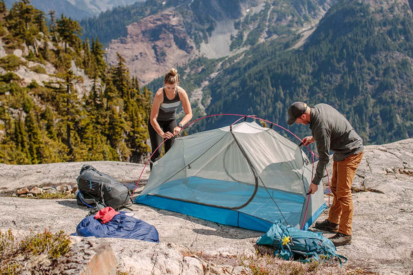
The Zion 2P Backpacking Tent makes a great 2-person shelter for the Sierra's unpredictable weather.
SHOP NOWOn the other hand, if you're planning your trip during the summer “bug season”, a lightweight mesh bivy and tarp may the best choice for shelter.
No matter what time of year you go, nothing beats a comfy seat after an arduous day of hiking.
If there's anything else you need to complete your pack, visit our full line of high-quality, affordable backpacking gear.
Shop Backpacking Tents
Shop Ultralight Tarps
Shop Backpacking Quilts
Shop Down Sleeping Bags
Shop Insulated Sleeping Pads
Shop Backpacking Pillow
Shop Folding Trekking Poles
Shop Titanium Cookware
Shop Tent and Tarp Accessories
Finally, to make sure you don't forget something at home, use our Ultimate Backpacker's Packing List. It even includes a convenient printable checklist!
Do I need a permit?
You will need to acquire several permits in advance for your trip. Wilderness Permits are needed for Inyo National Forest and Kings Canyon National Park. Inyo will issue your John Muir Trail permit (since you will be starting your trip in Inyo National Forest). You will also need an exit permit for Mt. Whitney. You get to avoid the lottery of the day-use and overnight permits, but you will still need to acquire an overnight one if you plan on staying at one of the base camps before ending your trip.
Links to permit pages have been provided below. Please be sure to read over them carefully as guidelines for each park/forest do vary some, like when it comes to group sizes.
Resources
Inyo National Forest-Wilderness Permits
John Muir Trail Guidelines
Sequoia and Kings Canyon-Wilderness Permits
Recreation.gov-Mt.Whitney Exit Permit
East Side Sierra Shuttle
Have you summited Mt. Whitney or completed any of the Pacific Crest Trail? What other great hikes have you been on that you would like us to write about? Leave your comments and suggestions below!
Read Next
If you're looking for more hike ideas in the west, read our "Best Backpacking Trips on the West Coast" and "Best West Coast Mountain Backpacking Trips"
roundup posts. Also, the following Hike of the Week articles cover other amazing hikes in California.
Hike of the Week: Lost Coast Trail
Hike of the Week: John Muir Trail - Part 1
Hike of the Week: John Muir Trail - Part 2
Hike of the Week: Skyline-to-the-Sea Trail
Hike of the WeeK: Thousand Island Lake Loop
Hike of the Week: Rae Lakes Loop
Hike of the Week: Trans-Catalina Trail
Hike of the Week: Joshua Tree National Park
For even more amazing backpacking trips visit The Trailhead, our interactive hike map. It contains a curated list of dozens of hikes, each with a detailed writeup like this one.

Finally, check out our comprehensive list of backpacking articles that cover just about everything there is to know about backpacking. If you're just starting out, our Backpacking 101 section covers all the basics. If you already have a few trips under your belt, you can find more advanced topics covered in our Expert Articles.


I did this hike Aug 2024 and it was awesome! This is an excellent write and is very accurate. (Amanda you need a Onion Valley – to – Exiting Mt Whitney Permit)
Hi, Love this writeup and very interested to do this hike. I was wondering if you could be more clear on what permits are needed?
Leave a comment