
This is a weekly series that highlights an outstanding day hike or backpacking trip. The goal is to inspire you to want to get out and see these places for yourself. I know for us, just seeing amazing photos and reading about a great hike is enough to get us motivated.
This week we pick up the second half of the epic John Muir Trail in California's Sierra Nevada. Here's the link if you want to read up on the first half.
Why This Hike?
The iconic John Muir Trail (JMT) will take you through some of the most beautiful valleys and mountains that California has to offer. The trail offers so much: a long and challenging backpacking trip, diverse landscapes, and lots of fellow hikers to meet along the way. The other nice thing is that the JMT can be split into two parts. This segment covers the southern half, starting at Muir Trail Ranch, and ending at Mount Whitney portal.
- Distance: 103 miles
- Difficulty: Strenuous
- Type: Point-to-point
- Best time: Early June-September
- Plan on spending 9-12 days on this section.
- This thru-hike is popular and there are also many popular day hikes in the area. Don't expect a ton of solitude on this hike.
- Some highlights include Glen Pass, Kings River, waterfalls, beautiful meadows, Rae Lakes, and Mt.Whitney.
Before jumping into planning your John Muir Trail experience, keep in mind:
- Weather conditions in spring and fall can be very poor, especially at Mt. Whitney.
- There is a lot of elevation gain, so some training is recommended.
- Most hikers choose to go south to north, providing an opportunity to acclimate and avoid altitude sickness.
- Backcountry permits are needed, so plan ahead
How Do I Get There?
Getting to Vermillion Valley Resort has become incredibly simple, thanks to their award-winning shuttle service that will pick you up right at the Fresno Airport and other major hotels. We definitely recommend booking ahead as each shuttle can only hold ten hikers and their gear.
Once you have reached Whitney Portal, you can catch a cab or taxi to the airport in Mammoth Lakes, or catch a shuttle to Burbank. There are also shuttle services from Mt. Whitney back to Yosemite Valley if you are through hiking and looking to get back to where you started.
Map of Recommended Route
The following outlines our recommended route for the southern portion of the JMT. As shown, we recommend a 12 day / 11 night itinerary, which means you’ll need a couple of weeks off to complete this section. The second part of the hike also lands you at Mt. Whitney, which you can choose to summit. If you do, add an extra day, as the mountain is steep and a very difficult climb.
For even more detailed mapping, including being able to print a copy for yourself, click the "Open in CalTopo" button at the top of the map once it's loaded into view.
This route is the most straightforward option, without any scenic side-trips that you might want to take along the way.
- Day 1 - Muir Trail Ranch to McClure Meadow (10.6 miles)
- Day 2 - McClure Meadows to NE Helen Lake (12.2 miles)
- Day 3 - NE Helen Lake to Deer Meadow (11.3 miles)
- Day 4 - Deer Meadow to Kings River (12.0 miles)
- Day 5 - Kings River to Woods Creek (11.6 miles)
- Day 6 - Woods Creek to Vidette Meadow (13.2)
- Day 7 - Vidette Meadow to Tyndall Creek (12.0 miles)
- Day 8 - Tyndall Creek to Guitar Lake (12.1 miles)
- Day 9 - Guitar Lake to Whitney Portal (16.0 miles)
If you have been following along the trail to this point, then you have probably enjoyed a long rest day and restock at the Muir Trail Ranch! The second half of this hike will require you to lift up your heavy backpacks to your already weary shoulders and tackle some of the most challenging terrains along the JMT. At the end of your journey you will see gorgeous Mount Whitney, and with the right portal pass, can choose to ascend it to finish off this amazing journey.
Trail Description
Day 1 - Muir Trail Ranch to McClure Meadow
The first day on the southern half of the JMT provides two things: a quicker hike with fewer terrain challenges, and the gorgeous and wild entrance to Kings Canyon National Park. If you have been feeling like the trail was a little too well-kept, and touristy, then Kings Canyon will give you gorgeous views of pristine nature.
When you leave Muir Ranch Trail, you can either walk along the lower valley by the river. Or, opt for a more challenging hike through the high valley. You will be crossing bridges and hiking through steep terrain. Make sure to cross on bridges as the rivers move fast and can be deadly during high runoff. You know you are on the right track when you hit Evolution Creek. After some steep switchbacks you will hit your destination, McClure Meadow.
Day 2 - McClure Meadow to NE Helen Lake
The second day is not about distance, it’s about elevation. You will be seeing the iconic Muir Hut, a stone building that sits atop Muir Pass. The day starts out as a gradual hike up. But, you will soon hit more switchbacks that take you well above the tree line. This is an incredibly hard section of the hike. You are exposed above the tree line to hot sun or gusts of wind and the switchbacks are never ending. Eat lots of food and drink plenty of water as you work your way up to the Muir Hut. Once you hit this iconic stone structure, it will just be a hop and skip over to the little Helen Lake where you will set up camp and restock on water.
Day 3 - NE Helen Lake to Deer Meadow
Day three starts well above 11,000 feet at your campsite. That said, it's incredibly important to stay hydrated and well-fed to reduce the potential for altitude sickness. It’s going to be cold and exposed, so this is the section of the hike to bust out those layers and fire up some warm beverages. Luckily, you are descending today into Le Conte Canyon. However, there will be some steep sections to get through, so watch your step.
If you are a faster hiker, then try to leave later in the morning as this section will most likely have snow that is frozen over in the morning. Regardless, if you have them, break out the trekking poles for extra stability. You will continue downhill through gorgeous lush valleys and watch the Kings River form from small creeks to raging waters. Follow the signs towards Palisade Creek. You can stop there for the night or continue through to Deer Creek.
Day 4 - Deer Meadow to Kings River
Day three was fairly leisurely and beautiful, so day four is going back to 12 miles of challenging climbs and descents. You are tackling the Golden Staircase today, so hopefully you trained on a stair stepper before you came. The otherwise ethereal nickname came from a series of grueling switchbacks that take you on a steep uphill journey in a short distance. You will eventually see the gorgeous twin Palisade Lakes and follow the northeastern trail. This will give you a stunning and daunting view of Mather Pass.
There is a steep hike up Mather Pass, but the descent down the back is the truly scary part. It is incredibly steep and rocky! Once you're down, there is one last push to South Fork Junction. Hopefully, you woke up early today to avoid setting up camp in the dark.
Day 5 - Kings River to Woods Creek
Day five is your halfway day. Unfortunately, it's another tough day. You'll be climbing most of the day, along with crossing the Kings River, on your way up to Pinchot Pass. Luckily, the gain to reach this pass isn’t quite as daunting, and there are plenty of lakes to refill on water today. The descent is longer than the ascent, so you will likely be tired by the time you stumble into Woods Creek. There are little waterfalls all along the trail and plenty of spaces to camp in. Make sure to get some rest and catch up on sleep. You will be going over Glen Pass on day six, which can be difficult on tired legs.
Day 6 - Woods Creek to Vidette Meadow
Day six overlaps with one of our other Hikes of the Week: Rae Lakes Loop. If you only have 4-6 days to spend in this beautiful area, check out our write-up on the loop.
Make sure to wake up early on the morning of day six. Heading out, you will get to experience your first suspension bridge out of Woods Creek. After crossing the narrow, one hiker at a time bridge, buckle up, because you are ascending to Glen Pass!
Climb up through the forested area, past Dollar Lake, which is a perfect place for a quick snack in the shade. Then, keep going until you see the three Rae Lakes. You will thread between two of the lakes and see the iconic, and definitely photo worthy, Painted Lady dome. Unfortunately, you have another 4 miles to tackle over difficult terrain across Glen Pass. You will continue on to Upper Vidette Meadow on the other side. After a long day of pass crossing, take a rest and enjoy the beautiful views.
Day 7 - Vidette Meadow to Tyndall Creek
Day seven is another high altitude day. You will be crossing the highest peak of the PCT, the top of Forester Pass. You will emerge from the nicely forested area and go high above the tree line, scrambling amongst rocks. Wake up before the sun rises to avoid doing this section with the hot afternoon sun on your back.
Once you hit the top, have a snack. You will need to be alert while you descend the narrow (and likely snowy) switchbacks. You will eventually hit another climb up to the Bighorn Plateau and head through to Wright Creek. Today you'll finally see signs for Mt. Whitney. While that may make your pace pick up, there is still quite a ways to go!
Day 8 - Tyndall Creek to Guitar Lake
With your enthusiasm to finish at an all-time high, pick up your now considerably lighter packs and start out day eight, your second to last day on the trail! The destination is Guitar Lake. You will be doing a lot of up and down today. But, it is a relatively short hiking day which will help for the big climb on the last day. The kicker to the rest of the trail starts in Crabtree Meadows; you will now need to either pick up or unpack a wag bag for all of your restroom needs. From here on out its pack in, pack out ... everything!
Day 9 - Guitar Lake to Whitney Portal
Mount Whitney is the tallest peak in the continental United States, and the JMT does not spare you by skirting around it. At 14,505 feet above sea level, your last day on the trail will be all about going up, up, and up. Get an incredibly early start, as taking on the mountain in the afternoon can be brutal. Grab your headlamp and start as early as possible. Some hikers even choose to start at midnight!
You will eventually see the trail sign for Mt. Whitney and Whitney Portal. At this point, you're only two miles to the true summit, but it is steep and treacherous. If you've started early enough, you may be lucky enough to stand on top of the tallest peak at the end of the JMT and see the sun rise! Once you come down, the easiest place to exit is through the ten mile Whitney Portal, where either a car or shuttle will be waiting for you. It will be a long way down, but hopefully you will be eager to enjoy that hot meal and frosty beer waiting for you at the end!
(It's worth noting that if you decide to skip the mountain, Whitney Portal is about 11 miles from Guitar Lake.)
What Will I Need?
This is an extended backpacking trip, so you’ll need to plan well to have a safe and enjoyable time. Backpacking along the JMT requires that you use a pre-approved bear canister. Most canisters can only hold about 5-7 days of food. So, you’ll need to plan well and be stingy with your food supplies.
Because of the length and difficulty of this hike, you'll want to keep your pack as light as possible. Make sure you only pack what you absolutely need. This will, of course, include a tent, sleeping bag/quilt, sleeping pad, cooking pot and stove, and water filter. Trekking poles are highly recommended for this trail too!
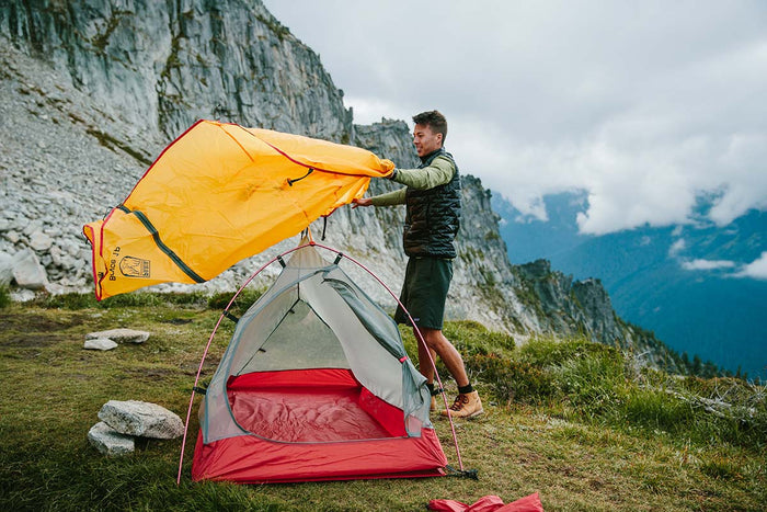
Our Bryce 1P backpacking tent is lightweight and weatherproof, which makes it a great option for the John Muir Trail.
SHOP NOWIf there's anything else you need to complete your pack, visit our full line of high-quality, affordable backpacking gear.
Shop Backpacking Tents
Shop Ultralight Tarps
Shop Backpacking Quilts
Shop Down Sleeping Bags
Shop Insulated Sleeping Pads
Shop Backpacking Pillow
Shop Folding Trekking Poles
Shop Titanium Cookware
Shop Tent and Tarp Accessories
Finally, to make sure you don't forget something at home, use our Ultimate Backpacker's Packing List. It even includes a convenient printable checklist!
Do I Need a Permit?
Backpacking the JMT requires permits and you’ll need to book them least six months in advance. A backpacking permit will give you portal access, but you are also going to want to reserve individual campsites. While you can ‘wing it’ and hope for open spots, the trail is popular and we don’t recommend going this route. Visit the National Park Service website for more information regarding permits and how to apply for them.
Don’t panic if our recommended route is booked for your target dates, there are plenty of ways to modify the JMT. The JMT permit will also allow you to go up Mt. Whitney. However, the mountain is incredibly crowded with daytime hikers and through hikers, so be prepared for crowds during the peak summer season.
Resources
Yosemite National Park JMT Permits
Vermilion Valley Resort Shuttle
Conclusion
Have you done segments of the JMT, or perhaps the whole trail? Tell us about your experience in the comments below!
Read Next
If you're looking for more hike ideas, read our “Best Backpacking Hikes in Sequoia National Forest” round-up post. Also, the following Hike of the Week articles cover other great trails in the region.
Hike of the Week: John Muir Trail-Part 1
Hike of the Week: Rae Lakes Loop
Hike of the Week: Thousand Island Lake Loop
For even more amazing backpacking trips, visit The Trailhead, our interactive hike map. It contains a curated list of dozens of hikes, each with a detailed write-up like this one.

Finally, check out our comprehensive list of backpacking articles that cover just about everything there is to know about backpacking. If you're just starting out, our Backpacking 101 section covers all the basics. If you already have a few trips under your belt, you can find more advanced topics covered in our Expert Articles.


Leave a comment