
Welcome to our Hike of the Week series! Each week, we strive to inspire you to not just dream about your next big adventure, but get out there and go for it! From short overnight trips to week-long treks, we hope to provide hikers of all skill levels with the perfect hike.
This week's adventure takes us to Montana's Absaroka-Beartooth Wilderness and “The Beaten Path” Trail.
Featured Photo: Fossil Lake Descent (photo by Robert)
Why Hike the Beaten Path?
The Absaroka-Beartooth Wilderness spans an impressive 944,000 acres of southern Montana and northern Wyoming. It is comprised of several National Forests and boasts over 700 miles of trails. Part of the greater Yellowstone ecosystem (the A-B Wilderness is located at the northeastern edge of the National Park), you are guaranteed some of the most scenic views in the U.S.
- 26 miles point-to-point trail
- Elevation gain of 3,400 feet
- Rated as moderate, with some difficult sections
- 3-days, 2-nights recommended
- Best time to visit is July through September
- Dispersed camping is allowed (always follow the Leave No Trace rules) and plenty of designated sites are available next to most of the lakes
- Passes next to or near 16 lakes
- The trail is marked well, easy to follow, and well-maintained
- There are plenty of opportunities to go off on side trails and extend your trip
- Great for trout fishing in the numerous lakes and streams
- A diverse array of scenery, including waterfalls, evergreen forests, and wildflower meadows
- Hikers rave about the trail's beautiful scenery, with a large majority saying it was the best trail they have ever hiked and that they would do it again
- Each trailhead offers primitive car camping campgrounds, giving you an extra opportunity to prepare for your trip or unwind afterward
Before you pack your bags, here are a few things to keep in mind:
- The Beaten Path is also horse-friendly, so you may run into horses during your trip
- The trail can be very busy due to day hikers, especially between the East Rosebud Trailhead and Elk Lake, which is only 3.5 miles). This is especially true on weekends and holidays.
- You will need to arrange transportation (i.e. drop a car off at either trailhead), arrange a “car swap” with other hikers, or treat this trail as an out and back. (The East Rosebud Trailhead and Clarks Fork Trailhead are about 3 hours apart.)
- Although most hikers suggest starting at the East Rosebud Trailhead for the views, it should be noted that the elevation gains are greater. You will be climbing for over half of your journey, but most of the ascents are gradual and include switchbacks.
- Grizzly bears are the main wildlife threat in the area, especially during berry season, so be “bear aware” and make noise now and then along the way.
How do I get there?
For those of you flying into the area, Billings Logan International Airport in Billings, Montana is the closest commercial airport. Although the Wilderness area is rather remote, it's only a couple of hours by car (85 miles) from Billings.
From Billings Logan International, head south toward E Airport Road. Follow signs through town for I-90BL (W Laurel Road). Follow signs and merge onto I-90W/Butte. Continue for 36.8 miles. Take exit 408 outside of Columbus, MT onto SR 78. Follow the signs through town to stay on SR 78.
Continue on 78 for 26.8 miles. Turn right onto E Rosebud Road on the east side of Roscoe, MT. Continue for 14.4 miles. E Rosebud Road eventually turns into Lake Road about half a mile before you turn left onto an unmarked road that takes you to the East Rosebud Trailhead.
Map of Recommended Route
The following map outlines our recommended route. Click the "Load Interactive Map" button to load the correct map. Once loaded, you can navigate along the route and view recommended camp sites.
Although The Beaten Path is a moderate 26 miles, we recommend a 3-day, 2-night trip to allow yourself time to enjoy all of the beauty it has to offer.
- Day 1: Rainbow Lake (8 miles)
- Day 2: Fossil Lake (8 miles)
- Day 3: Clarks Fork Trailhead (10 miles)
Trail Description
Day 1 - Rainbow Lake
Begin your journey south from the East Rosebud Trailhead, first passing by East Rosebud Lake. The first few miles of your hike pass through an area damaged by a forest fire in 1996, which is still recovering. With the relatively small height of the trees growing here, you can enjoy plenty of views of the East Rosebud Creek along the route.
Next, you will come across the popular Elk Lake. Being only 3 ½ miles from the trailhead, this is a popular day hike. Other than views of the lake itself, you can also enjoy seeing nearby Froze to Death Plateau.
Although not too strenuous, your first climb will begin after this point. Hike past mature forests and rock fields for the next 3 miles with an elevation gain of around 900ft. These rock fields can become brutally hot in the afternoon, so make sure to stock up on water at the plentiful sources along the route and wear sunscreen.
You will next come upon Rimrock Lake, where you can first take in the view from an overlook. Continue on the convenient footbridge spanning the foot of the lake and continue on to your final destination for the day.
Continue for just two more miles before reaching Rainbow Lake and its campsites. The journey here is gloriously shady. This lake is a popular one along the trail because of its excellent fishing opportunities and numerous campsites. With that being said, this area can become crowded during peak times. If you can't find a spot here for the night, continue on a little way further to find a spot to bed down for the night.
Day 2 - Fossil Lake
Enjoy a few more views of Rainbow Falls from above on your departure as you climb 500ft over the course of a mile. Soon you will come upon the next body of water, Lake at Falls. You will find it aptly named with two waterfalls that plunge hundreds of feet into the lake.
Continue on through shady forests to Big Park Lake. This lake is rather shallow and can look more like a marsh than a proper lake. Meander through more dense forests, where you may find a plethora of ripe berries during the right time of year. (Just remember that bears also love berries.)
After 2 more miles, Duggan Lake will appear. While the lake itself is fairly small, it is most notable for Impasse Falls, which plummets into the lake, and is said to be the best waterfall along the trail. Not only does the trail bring you alongside the falls, it leads you to the top of it with plenty of switchbacks and scenic viewpoints along the way.
You will pass a couple more waterfalls, as well as more boulder fields, over the next few miles as you pass by Twin Outlets Lake and Dewey Lake. As if the views thus far weren't incredible enough, the next two miles or so of trail are said to be the most scenic. You will pass by boulder-field meadows, which can provide wildflowers as late as September, views of mountain peaks and plateaus continuing for as far as the eye can see, and more winding streams on your way to Fossil Lake, where you will be spending the night.
Day 3 - Clarks Fork Trailhead
Luckily, most of your journey today will be downhill. You will pass by several more lakes along the way, including Windy, Skull, Bald Knob, and Ousel Lakes. The breath-taking scenery continues with steep plateau and mountainside walls falling sharply next to the lakes. Traverse a series of switchbacks past Ousel Lake on your descent to Russell Lake. If you're feeling the need to bathe some by now, this lake is said to be much warmer than the rest, making it a perfect spot to wash off some of the grime of the past couple of days.
After your diversion at the lake, continue through another rock field and eventually make your way back to the forest. Over the last 6 miles, you will come across at least 3 short side trails to even more lakes. Pass by Kersey Lake to the south and continue until reaching the Clarks Fork Trailhead.
What will I need?
With grizzly bears inhabiting the area, the Forest Service suggests bringing bear spray as a safety precaution. Needless to say, bear canisters will also be a necessity on this trip.
The Absaroka-Beartooth Wilderness experiences average lows between 38 and 49°F during July through September. If you're planning your hike during this optimal time, a properly rated sleeping bag is a must. Don't forget an ultralight sleeping pad too! Consider a durable, lightweight backpacking tent as well to save your back as you hike.
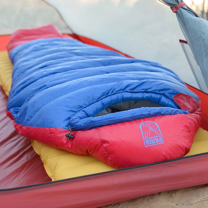
The Thermodown 15 Sleeping Bag is rated for 15 degrees, which makes it a great option for the overnight lows expected along The Beaten Path trail.
SHOP NOWAlthough Fossil Lake is arguably one of the most scenic lakes along the trail, campfires are not permitted here. Be sure to bring a lightweight titanium cooking pot to cook your meals over your camp stove.
If there's anything else you need to complete your pack, visit our full line of high-quality, affordable backpacking gear.
Shop Backpacking Tents
Shop Ultralight Tarps
Shop Backpacking Quilts
Shop Down Sleeping Bags
Shop Insulated Sleeping Pads
Shop Backpacking Pillow
Shop Folding Trekking Poles
Shop Titanium Cookware
Shop Tent and Tarp Accessories
Finally, to make sure you don't forget something at home, use our Ultimate Backpacker's Packing List. It even includes a convenient printable checklist!
Do I need a permit?
The Absaroka-Beartooth Wilderness does not require any backcountry camping permits. There are also no entry fees to the area.
Resources
Forest Service Trail Info
Trail Reviews & Photos
If you are looking for an ultra scenic hike with breathtaking views that isn't incredibly difficult, The Beaten Path may be just for you. Have you hiked this or any other trails in the Absaroka-Beartooth Wilderness? What other great hikes would you like us to write about? Leave us a comment below!
Read Next
If you're looking for more hike ideas in the west, read our "Best Backpacking Trips on the West Coast" roundup post. Also, the following Hike of the Week articles cover other amazing hikes in British Columbia and Alberta.
Hike of the Week: West Coast Trail
Hike of the Week: Nootka Trail
Hike of the Week: Sunshine Village to Mount Assiniboine
Hike of the Week: Della Falls Trail
Hike of the WeeK: Chilkoot Trail
For even more amazing backpacking trips visit The Trailhead, our interactive hike map. It contains a curated list of dozens of hikes, each with a detailed writeup like this one.

Finally, check out our comprehensive list of backpacking articles that cover just about everything there is to know about backpacking. If you're just starting out, our Backpacking 101 section covers all the basics. If you already have a few trips under your belt, you can find more advanced topics covered in our Expert Articles.


Just Curious think you guys would ever make one of these reviews but going down from cook into east rosebud ? I have gone up before al the way to lake of the falls. We are planning a trip this summer to go down from Cook City any pointers? what lakes to stay at ? we are going to fish up there for 4-5 days maybe even 6 so it will be a long trip ! thanks for posting these great articles! hope to hear from you !
Brian Flotkoetter
Leave a comment