
Welcome to Paria's “Hike of the Week” series. Each week, we highlight one of the most scenic or challenging trails from around the country. For us, just reading about a great hike is motivation enough to want to get out there and explore it ourselves. We hope these write-ups do the same for you!
This week takes us to a section of the Appalachian Trail (AT), from Davenport Gap to Max Patch Mountain, in North Carolina.
Featured Photo: Max Patch (Photo by ccho)
Why This Hike?
This section, located in the Cherokee National Forest, is one of the most popular AT sections in the state. It is a stone's throw away from the very northeast corner of the Great Smoky Mountains National Park. That said, you can avoid some of the more crowded areas of the Smokies here. But, you won't have to sacrifice the beautiful scenery. The trail is a hard trek uphill, but the 360° views atop Max Patch are worth it!
- Distance: 14 miles
- Type: Point-to-point
- Difficulty: Hard
- Elevation gain: 5,000+ feet
- Best time to go: Fall (beautiful foliage) and spring (easier to find water); The trail is open year-round, though.
- The Davenport Gap trailhead begins just off I-40, so it's easy to access.
- Highlights: Views atop Snowbird Mountain, ethereal forest walks, open meadows with awesome views of the surrounding mountains, spring wildflowers, and the best views of all at Max Patch.
- There is a nice camping area near the top of Max Patch Mountain. You could just push yourself and hike the whole thing in a day and camp there one night.
- Since this is part of the AT, it's easy to follow the white blazes. It's also easy to find shuttle services in the area.
Before you pack your bags, keep the following in mind:
- Water can be scarce during certain times of the year.
- From west to east, the trail is almost all uphill.
- You will need a shuttle or spot a car. Otherwise, you can make it an out-and-back.
- It's close enough to the Smokies that it's still very temperate rainforest-like here. It can get soggy, especially in spring. Plan accordingly.
How Do I Get There?
It's better to leave your car at Max Patch and get dropped off at the Davenport Gap trailhead. The latter does not have much room and it has a history of vandalism.
If you are flying in, your closest bet is Asheville Regional Airport in NC. From here, head north on Airport Road and use the left lane to merge onto I-26 W/US-74 W. Continue for about 9 miles before keeping left to merge onto I-40 W. Continue for 21 miles. Take exit 24 for NC-209 toward Lake Junaluska/Hot Springs. Turn right onto NC-209 N and continue 8 miles. Continue straight onto Max Patch Road for 4.3 miles. Make a slight left to stay on this road and continue about 8 more miles. The parking area will be on your right.
Total drive time is a short 1 hour and 20 minutes. Remember, this is where you will be dropping your car off. You will still need a shuttle to the other trailhead.
Map of Recommended Route
The following map outlines our recommended route. For even more detailed mapping, including being able to print a copy for yourself, click the "Open in CalTopo" button at the top of the map once it's loaded into view.
- Day 1 - Davenport Gap to Groundhog Creek Shelter (5 miles)
- Day 2 - Groundhog Creek Shelter to Max Patch (8 miles)
- Day 3 - Max Patch to Parking Area (0.6 miles)
Trail Description
Day 1 - Davenport Gap to Groundhog Creek Shelter
Start by heading up some precarious stone stairs. The first leg of your trip up Snowbird Mountain is taxing. Lots of rocks and roots line the way. If you go when the leaves aren't on the trees, you'll get some lovely views of the surrounding mountains on your way. The sunsets and sunrises are especially gorgeous. The forest is mostly deciduous trees. This makes for lovely fall foliage.
Take a deserved break on top of Snowbird and take in the never-ending views. There is also an FAA tower at the top. Head to Groundhog Creek shelter afterward near Deep Gap, your camp for the night.
Day 2 - Groundhog Creek Shelter to Max Patch
You'll finally get a little downhill hiking today. Lots of fern-covered undergrowth and quiet forest await. You'll know you're getting close to your destination when you reach the road crossing. More sketchy stone stairs lead the way to the top of Max Patch.
Plan your trip just right (and cross your fingers the weather cooperates) to experience a full moon on top. This beautiful, open grassy area above the trees is the perfect spot to do some stargazing! It can get pretty windy up there, though. Be prepared to head back into the trees for some cover.
On your last day, simply take the Max Patch Short Loop trail for a half-mile back to the parking area.
What Will I Need?
Spring and fall highs range between 48°F and 68°F, while lows range between 27°F and 47°F. If you plan on sleeping below the treeline, a hammock and tarp is a good warm-weather option. You won't have to worry about finding a flat spot for your tent. But, it can get pretty chilly at night, especially during the shoulder seasons. A durable backpacking tent is a good idea if you plan on sleeping atop Max Patch.
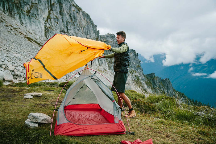
Our Bryce 1P backpacking tent is lightweight and weatherproof, making it a great option for the sometimes blustery weather atop Max Patch.
For inside your tent or hammock, a down sleeping bag will serve you well. An ultralight sleeping pad will protect you from the cold ground and save you on pack weight. For added comfort, consider a lightweight, compressible down pillow.
A titanium cooking pot is a smart option for backpacking. They're small, but get the job done. Plus, you can use them for warm drinks as well! Speaking of fluids, you might consider bringing a larger water bladder. Again, water can be scarce in this mountainous terrain.
If there's anything else you need to complete your pack, visit our full line of high-quality, affordable backpacking gear.
Shop Backpacking Tents
Shop Ultralight Tarps
Shop Backpacking Quilts
Shop Down Sleeping Bags
Shop Insulated Sleeping Pads
Shop Backpacking Pillow
Shop Folding Trekking Poles
Shop Titanium Cookware
Shop Tent and Tarp Accessories
Finally, to make sure you don't forget something at home, use our Ultimate Backpacker's Packing List. It even includes a convenient printable checklist!
Do I Need a Permit?
No permits are required.
Resources
Blue Ridge Hiking Company Shuttle Service
Roan Mountain Shuttle Service
Conclusion
For a quick trip in the awe-inspiring Appalachian Mountains of North Carolina, the route from Davenport Gap to Max Patch is one you won't forget! Have you hiked this section of the AT? We'd love to hear about your experience below in the comments!
Read Next
If you're looking for more hike ideas, read our "Best Backpacking Trips in the Eastern U.S." round-up post. Also, the following Hike of the Week articles cover other great trails in the region.
Hike of the Week: Art Loeb Trail
Hike of the Week: North Sterling Loop
Hike of the Week: Bartram Trail-Georgia Section
For even more amazing backpacking trips, visit The Trailhead, our interactive hike map. It contains a curated list of dozens of hikes, each with a detailed write-up like this one.

Finally, check out our comprehensive list of backpacking articles that cover just about everything there is to know about backpacking. If you're just starting out, our Backpacking 101 section covers all the basics. If you already have a few trips under your belt, you can find more advanced topics covered in our Expert Articles.


Leave a comment